2011
AMBATOVY SUSTAINABILITY REPORT
22
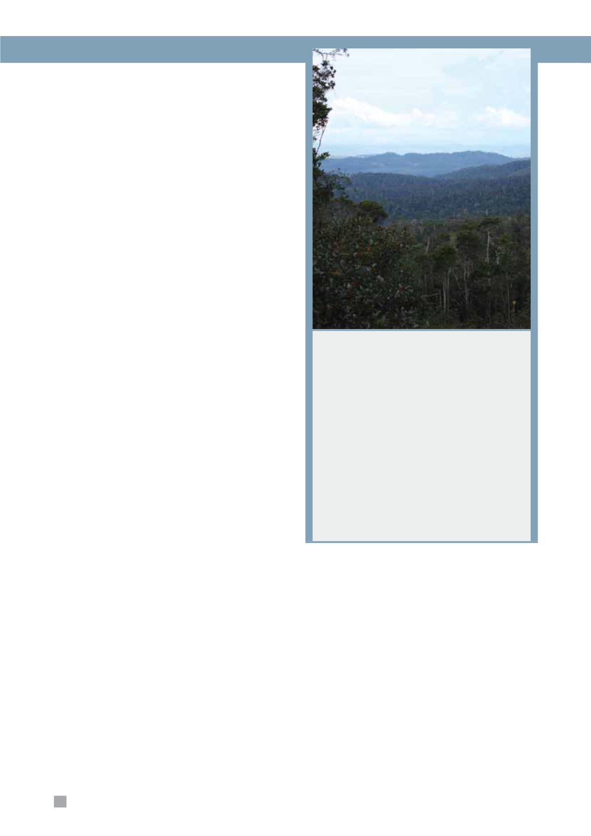
Helping to Create One of the
Largest Continuous Areas of
Protected Forest in Madagascar
Working with a number of local and international
stakeholders, Ambatovy is committed to supporting
the establishment of the Analamay-Mantadia Forest
Corridor (AMFC) linking the mine forests to the nearby
Mantadia National Park and the southern end of the
Ankeniheny-Zahamena Forest Corridor (CAZ). Once
officially protected, the CAZ, Mantadia National Park
and the AMFC will together constitute one of the largest
continuous tracts of protected forest in Madagascar.
During 2011, Ambatovy, with various partners,
worked towards official protection status for this area.
Protection of the AMFC will ensure habitat connectivity
between these key areas and avoid isolation of the
mine conservation forests.
Environmental Performance
On-Site Conservation Areas
Two parcels of azonal forest growing over the ore body
have been set aside and will not be mined, despite the
valuable nickel ore lying beneath them. The combined area
of these two parcels is approximately 300 ha. During the
Environmental and Social Impact Assessment, these azonal
forest habitats were considered to be a rare habitat type
compared to the more typical zonal forests of the Eastern
Forest Corridor. In addition, we have more than 3,300
ha on-site of transitional and zonal forests dedicated to
conservation. The conservation zone provides a buffer for
receiving the fauna leaving the mine footprint and as a seed
bank to facilitate ecological restoration of the mine footprint.
Torotorofotsy Wetlands
The Torotorofotsy Wetlands lie immediately to the east of
the mine and cover 9,776 ha of wetland, forest and other
habitats. In 2006, Torotorofotsy was classified as a wetland
of international importance under the Ramsar Convention on
Wetlands. We consult with the Government of Madagascar,
local NGOs and other stakeholders, and provide assistance
to promote and enhance management of the area. During
2011, we supported the development of a management plan,
biological inventories, hydrological studies and participated
in discussions to resolve management challenges affecting
the area. In celebration of International Wetlands Day on
February 2, 2011, Ambatovy co-signed, with the Regional
Forest and Environment Authority (
Circonscription de
l’Environnement et des Forêts, CIREF
), the renewal of a
management transfer contract with communities around the
wetland. Ambatovy will provide technical and financial support
to the managing communities.
Ankerana Offset
Ankerana is the centre-piece of Ambatovy’s Business and
Biodiversity Offsets Program. Ankerana is a low-to-medium
altitude forest lying 70 km to the northeast of the mine and is
linked to the Ankeniheny-Zahamena Forest Corridor (
Couloir
Ankeniheny-Zahamena, CAZ
). Ankerana comprises intact
primary forest, but is threatened by encroachment from slash-
and-burn agriculture in surrounding valleys. The site has a
total surface area of approximately 8,000 ha, of which 6,800
ha have been proposed as a core protection zone. In 2011,
Ambatovy put a team in place for Ankerana’s management.
Studies were undertaken in 2011 to assess the biodiversity
of the forest and monitoring was established to understand
the pressures on the forest, including agricultural clearing,
logging, hunting and illegal gold exploration. A number of
educational campaigns were carried out around the perimeter
to provide local populations with the knowledge needed to
ensure resource sustainability of the area. In addition, our
team started a multi-faceted livelihoods program in the area to
promote viable alternatives to unsustainable harvesting of the
forest. Ambatovy continued to work in collaboration with the
CIREF to establish forestry committees in the villages around
Ankerana.
Ambatovy is also supporting other actors who are
implementing sustainable management of other surrounding
forests adjacent to the mine, including those within the
Torotorofotsy Wetlands, through technical and financial
support. Examples of forests that benefit are:
3
About 9,800 ha of periphery forests to the east of the
mine footprint.
3
Approximately 3,100 ha of forested land within
the AMFC (in addition to the 8,319 ha core zone
mentioned previously).


