Environmental Assessment
Volume D-5.3
Process Plant
Land Use
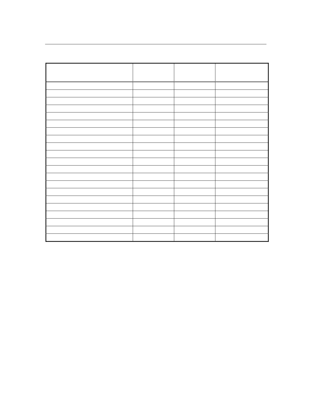
Table 5.3-1 Land Use Impact Areas for the Process Plant Local Study Area
Type of Area
Area Within
LSA (Baseline)
(ha)
Area
Impacted
(ha)
Proportion of Area
in LSA Impacted
(%)
degraded residual coastal woodland
166
29
17
azonal/transitional forest and scrub
0
0
0
primary zonal forest and marsh edge
0
0
0
degraded primary zonal forest
0
0
0
agroforest/secondary forest
0
0
0
plantation
151
0
0
woodlot
0
0
0
beach ridge complex
161
1
1
coastal shrubland/grassland complex
640
220
34
rice paddies
110
44
40
shrubland/herbaceous/pasture
105
6
6
tavy matrix
59
4
7
village/urban
9
1
11
wetlands
56
13
23
access corridor (road/rail)
11
4
36
industry (buildings or exploration areas)
0
0
0
canal
15
0
0
quarry
3
0
0
river/water
61
0
0
seasonal pond
0
0
0
total
1,547
322
21
The most valuable land use areas within the process plant LSA at present are
plantations, woodlots, rice growing areas, village areas and quarries. Within the
LSA, no plantations, woodlots or quarries are affected by the project. Forty
percent (110 ha) of potential rice paddy areas are affected. Eleven percent (9 ha)
of village or homestead areas are affected.
Eligible land owners and land users will be compensated though relocation to
properties of equivalent capability for agriculture; however, the process of re-
settlement may have other effects. These subjects are addressed in the
socioeconomic section (Volume E, Section 5.1).
Ambatovy Project
197
January 2006


